
Geography of the Isle of Skye
The Isle of Skye is a well known tourist destination. It can be found just off the northwest coast of Scotland and it has some incredible geography and geology.
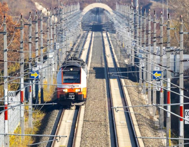
We know the greater area from popular culture. The famous “Train to Hogwarts” from the Harry Potter movies is just an hour to the south with it’s majestic Glenfinnan Viaduct. To the east is Loch Ness, and the Isle of Skye features prominently in the theme song to the TV Series “Outlander”.
You can reach the Isle of Skye by road across the bridge on the east end of the island. But there is also ferry service from Mallaig to Armadale on the southern tip of Skye. The island is the largest and northernmost of the major islands in the Inner Hebrides. It has an area of 1656 square killometers (639 square miles) and population of about 10,000. That number is nearly doubled in the summer with tourist visits. The main town is Portree on the northeastern coast of the island.
 Skye Map


The weather can be quite severe on the Isle of Skye. Cold weather, rain and high winds dominate for much of the year. In winter, there is often a dusting of snow to be found. But all of that is well worth it for the incredible physical features and geological history that makes the island so beautiful. Summer days rarely get above 60F (16C) and be ready for rain at just about any time. We visited last August and were lucky to encounter a glorious afternoon of sunshine and light breezes. The hills were lit up with heather of dog violet which gave everything a wonderful, purple look.
The Quirang and Old Man Storr: Geology
Some of the most amazing landscapes in the world can be found on the northeast corner of the Isle of Skye. The geography and geology of the Isle of Skye is well worth studying. This area is called the Trotternish peninsula and is home to a massive, ancient landslide. The features we see today are known as the Quirang and Old Man Storr. These formations were formed by a massive volcanic layer, some 1000ft (300m) thick. It lay on top of Jurassic era sedimentary rock. At some point the weight of the lava flows caused the massive slip or landslide. It exposed the underlying rock we see today. These formations of sheer cliffs and pinnacles are amazing to see. Go and hike around, but careful, the brittle rock makes them unsuitable for climbing. See our post about Arches National Park for more on geography and geology.
 Storr
Storr


The Fairy Glen
The Fairy Glen is a cool mixture of natural and made made features. Driving west from the parking area on the saddle at the Quirang, you move down to the coast through fields filled with sheep and large areas of heather. Skye’s weather makes it nearly impossible for any sizable trees to grow. Arriving at the Fairy Glen, we see that it is another landslip, but in miniature. It is a patchwork of round-topped hills and ponds. People have added circular stone gardens to add to the aura, and tails of faeries feature prominently in Scottish lore. Walking the trails among the many hills is a fascinating experience. The area receives far fewer tourists than the Quirang and Storr.
 Fairy Glen


Check out the YouTube video at the bottom which shows very impressive drone footage of the Quirang !
Where to Stay?
There are hundreds of places to stay on the Isle of Skye. They get booked far in advance. It can be a real challenge to find accommodations during the summer peak season. We had the great fortune of finding the Skye Cabins. These are located 5-10 miles northwest of Portree and offer three quaint cabins. One of them is round and offers absolutely stunning views of the River Snizort. This flows out to the Loch and on to the ocean.
 Skye Cabins


Add comment