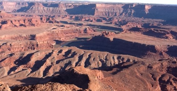
For my first Travel blog post for Maps4Kids, I thought I would start with what may be my favorite natural space – Arches National Park. To be honest, almost all of southern Utah is absolutely amazing, but there is something special about Arches. First of all, the beauty of the formations, the clarity and color of the sky, the dry heat that persists much of the year make this a great place to visit.
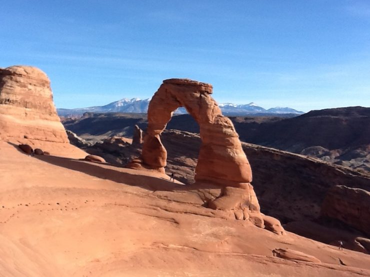
 Delicate Arch - Arches National Park
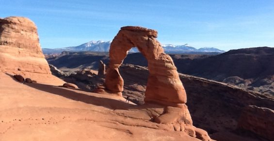

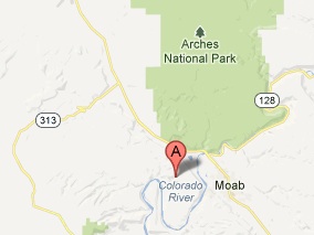
Where is Arches? Arches National Park is located in eastern Utah near the town of Moab. The Colorado River flows along the southern edge of the park. You can get there by taking I-70 to where it meets Route 191, then take 191 south until you reach Moab. The main park entrance is just north of town and well marked.
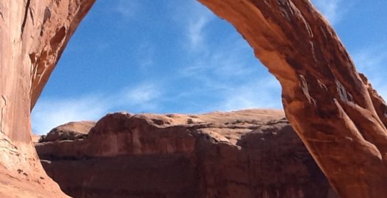
What are Arches? The Arches are rock formations formed mostly by wind and water erosion over long periods of time. Bits of rocks will be worn away until pockets are exposed. These continue to erode until larger and larger sections fall away, and in these rare cases leave an arch. These arches may collapse at any time, others may last for thousands of years. The image below shows the process over time:

My visit to Arches. I have been to Arches twice – once in 2001 and again just last October. The first trip was in December and it was quite cold but sunny and dry with a dusting of snow in places. The park was very empty that visit. In October 2012, I visited again and it was a good deal warmer and the sky was an amazing blue ! I entered the park through the main entrance and got a map and my passport stamp for visiting. It is really fun to get a National Park Passport Book and gets stamps for all of your visits. The stamp for Arches will look something like this:

As you enter the park, the main road winds its way up through some massive formations leading you to an elevated plateau with great visits in all directions. Once in the park, there are plenty of parking areas, hiking trails and vista points. One of the first formations you come to is Balanced Rock. It really lives up to its name !

My favorite place in the park is Delicate Arch. To get there, you need to drive to Wolfe Ranch, about 13 miles into the park. There is a sizable parking area there with toilet facilites. In order to get to Delicate Arch, it is a hike of about 1.5 miles and mostly uphill, though not too steep. The best times of day to visit are sunrise and sunset, as the sunlight on rock of the arch makes for some great photo ops.
About Moab. Moab has become quite a fast-paced tourist town and grew considerably in the 10 or so years between my visits. There are many hotels and eateries as well as a host of companies that can help you with really fun adventures like ATV, rafting, ballooning, hiking and other tours. A good place to start is the Discover Moab website. I hope you get a chance to go and see Arches and, if you do, let me know what you thought !


[…] of Physical Geography – the study of natural features. One of our other posts discusses Arches National Park, a place rich in features of Physical […]
[…] to see and hike around, but the brittle rock makes them unsuitable for climbing. See our post about Arches National Park for more on geography and […]